Where does it come from?
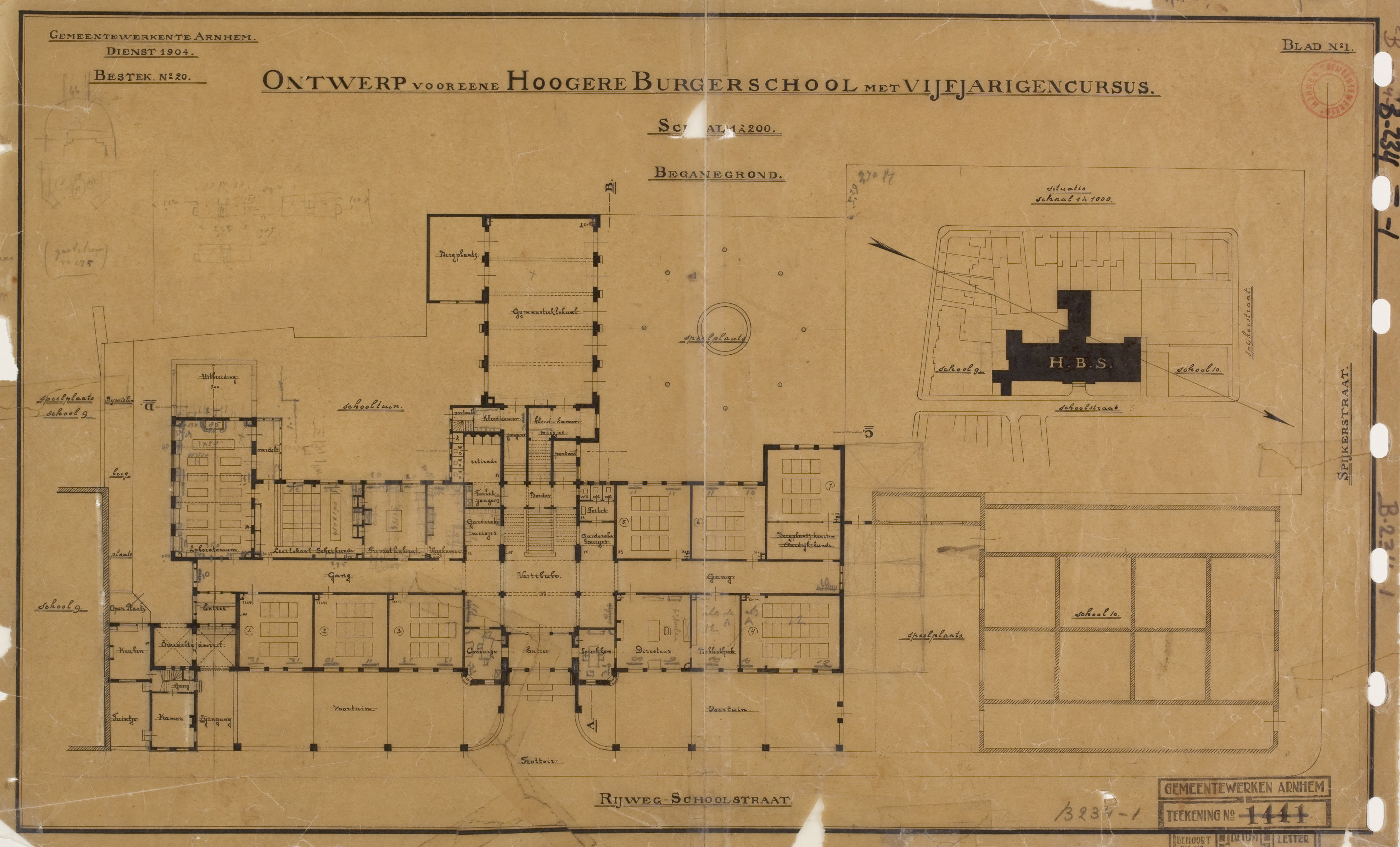
The Gelders Archief has about seven architectural plans of the school, and ten of the neighbourhood it is located in.
It is 1904. Plans for the school are made. Everything has a specific function. The important rooms are outlined, the descriptions carefully noted. Everything, even the empty space.
It is marked in two of the documents; it has a name in only one.
"Open Plaats" - Open Place, Open Space, Open location.
A cartographer makes notes so the constructions can be accurate. These names are set on paper, setting into place what this space is going to be - for us, and for those before us. But what is an "Open Space"? Is it free for use? Is it a few sqare meters that happen to be open? Why specifically this space?
It is interesting that the storage, the open space, they still exist as they were on a map in 1904. The only difference is that back then, the kitchen building had a south-west window and door.
There it made sense to create an "open space". A space needed to enter - and exit. Why the pathway just didn't extend - who knows. Maybe it was more pleasing to the eyes of the architect. Maybe the kitchen needed an elevated platform for the south-west door.
The "Rywelen Bergplaats" is still a bike storage, the "Keuken" is still a kitchen (if you sneak a peek, you see the sink) and the "Open Plaats" - is still open. But what changed, is that the door to the kitchen is gone. It vanished. It is another window, looking at the forgotten fence piece. You occasionally get a glimpse at construction racks, the building is so old it needs constant maintenance.
With all this history, it is surprising this emptyness had a name all along. from the beginning of the school, until now it still owns it, and perhaps serves its name even more: Open Space: free for all, unseen by everyone.