digital maps, cartography. the place from above.
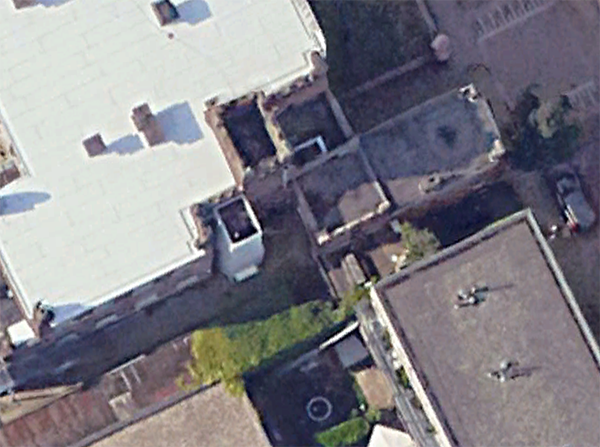
The first think I looked up wasn't actually the city archives - it was a satelite images from google earth, trying to find the space from above.
It's simple to find the address, but what is not so simple is to actually define where the open space begins - and where it ends. The satellite images tend to become blurry when zooming in, and the tiles are not showing.
I don't expect Google to give me a hires image equivalent to its street view reality emulating images it uses for the Eiffel tower. But it is still fascinating to see that as much as google maps or other digital map services seem to capture the real world and its locations, it still misses a lot. The unrecognized, awkward and uncanny spots in immediate vacancy are rendered to be blur of colours and pixel. They might as well not exist.