a real place doesn't like to be copied.
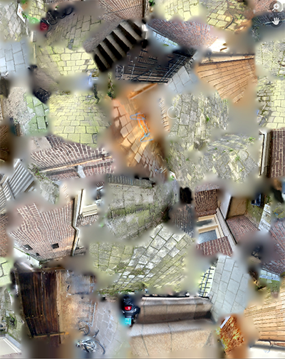
Copying a real place into the digital isn't all that hard. One of many ways is Photogrammetry, which in this case LiDAR technology was used to map the open space as a grid, with UV and texture map added to it. Viewed as a whole, they ARE a direct copy of what is seen: A light sensor recognizing the distance, the camera creating many images to create the textures.
Individually, these elements seem disconnected, almost dreamlike. You never quite know where what is, and what belongs together; only in a 3D program you can get the sense that the physiscal space got put together again digitally.
All of this can be done in a matter of minutes, the programs already know what to do with the datapoints. What is more complicated however, is to manifest this copy into the physical world again.
However, trying to bring a 244 by 270 cm space into the physical again is harder than it looks.